one spreading liquid manure in a snowy field
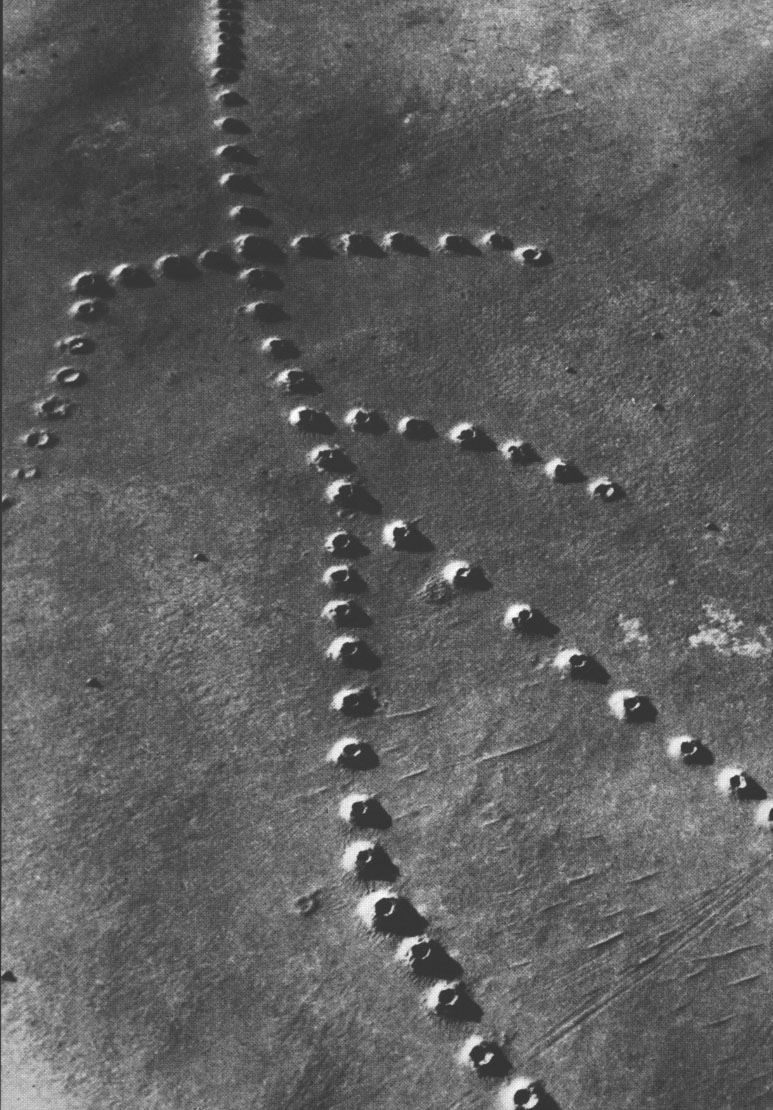
two unguessable --but you're looking at what shows on the surface above a qanat (see also Building a Better Qanat, and a picture at ground level). This one happened to lead me to wayhoo.com, a remarkable service for finding geographical coordinates
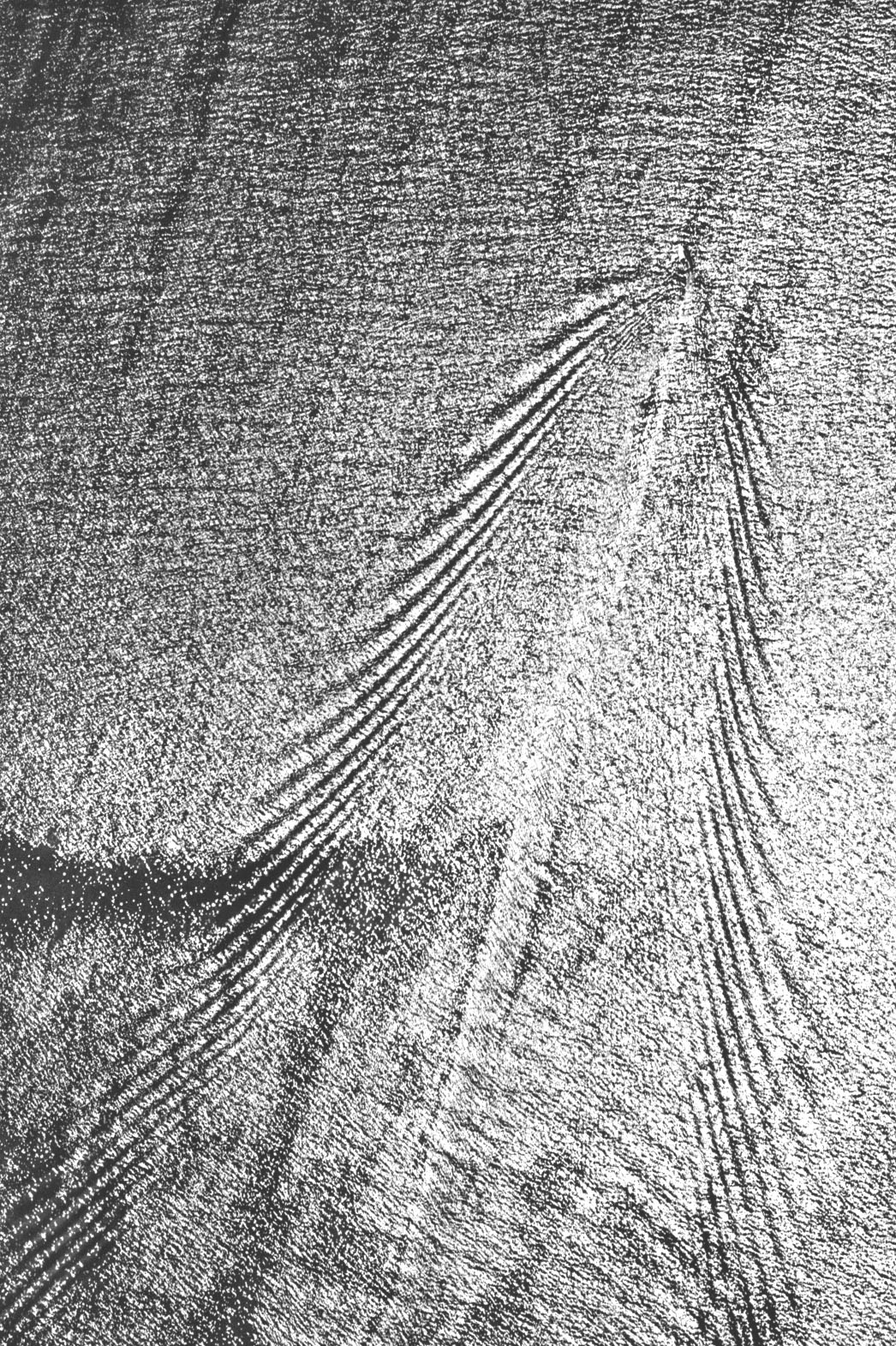
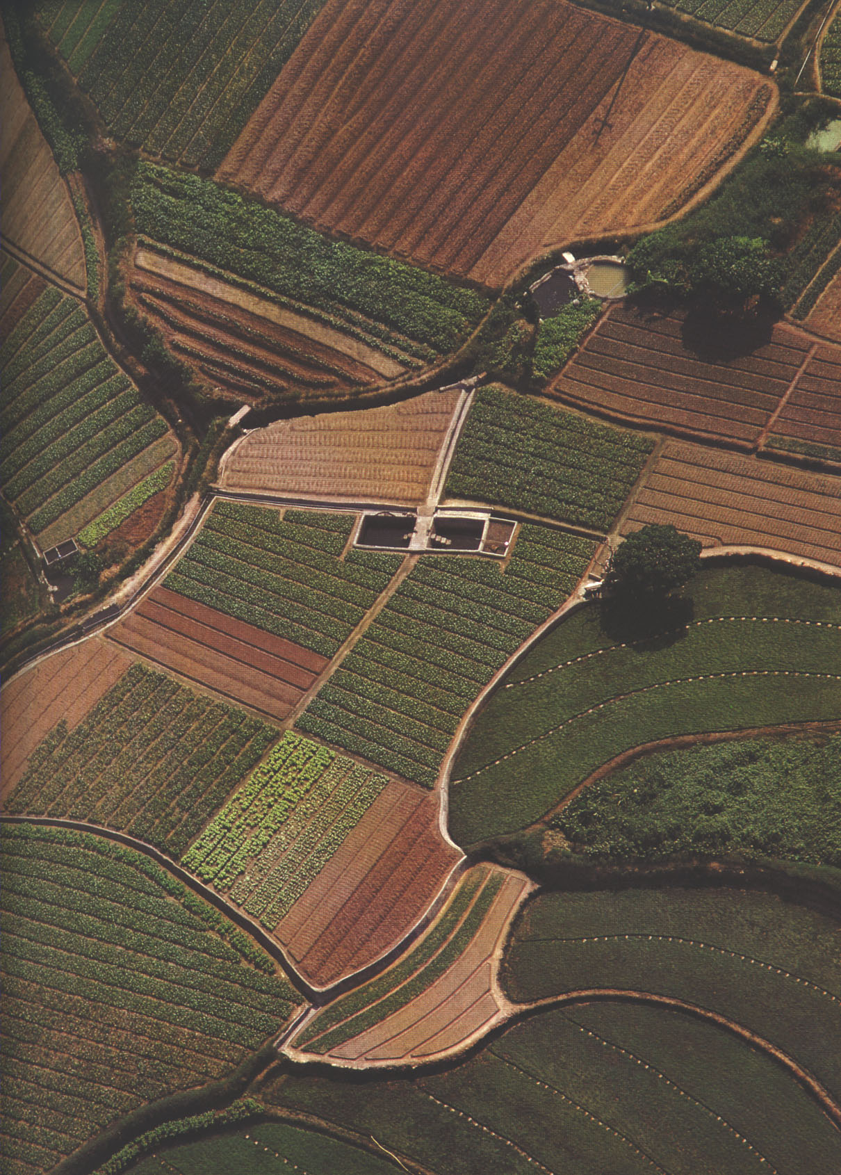
three a relatively easy one, but the beauty is that it's a snapshot of TIME
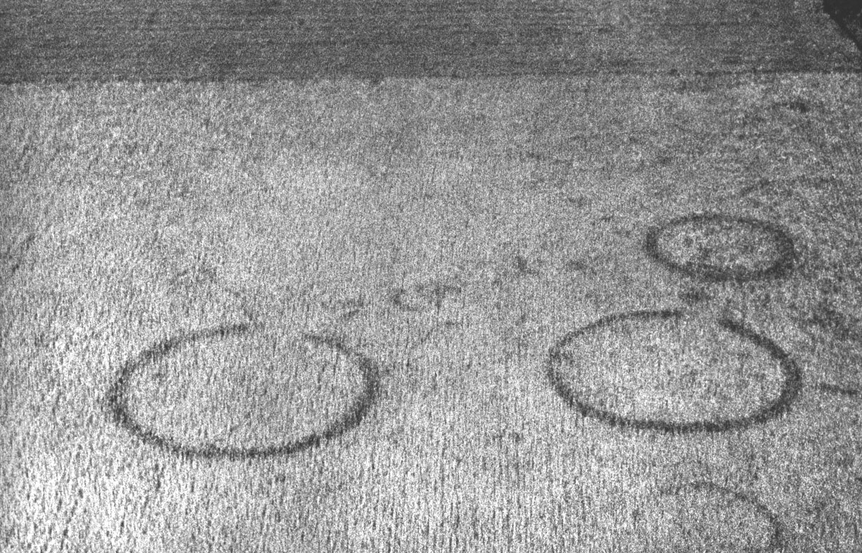
four another image of TIME, this time a matter of thousands of years. See How Do Archaeological Sites Show..., Cropmarks show as differential growth in arable crops caused by the presence of sub-surface archaeological features...", and BBC aerial archaeology
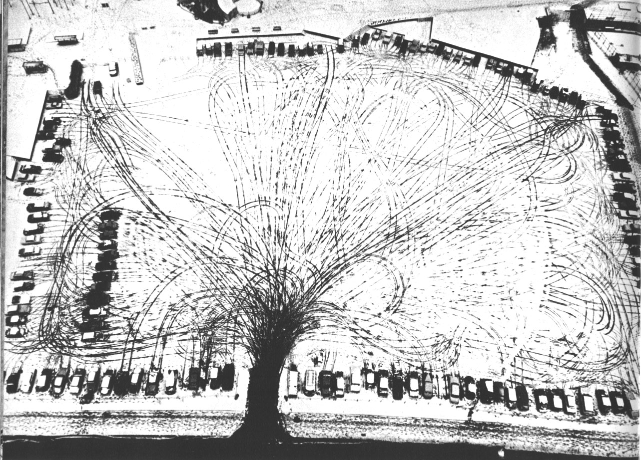
five so much in this one: time (could you reconstruct the order in which the cars entered the parking lot?), strategy (some have backed into the spaces, to make it easier to get out...), and perhaps more
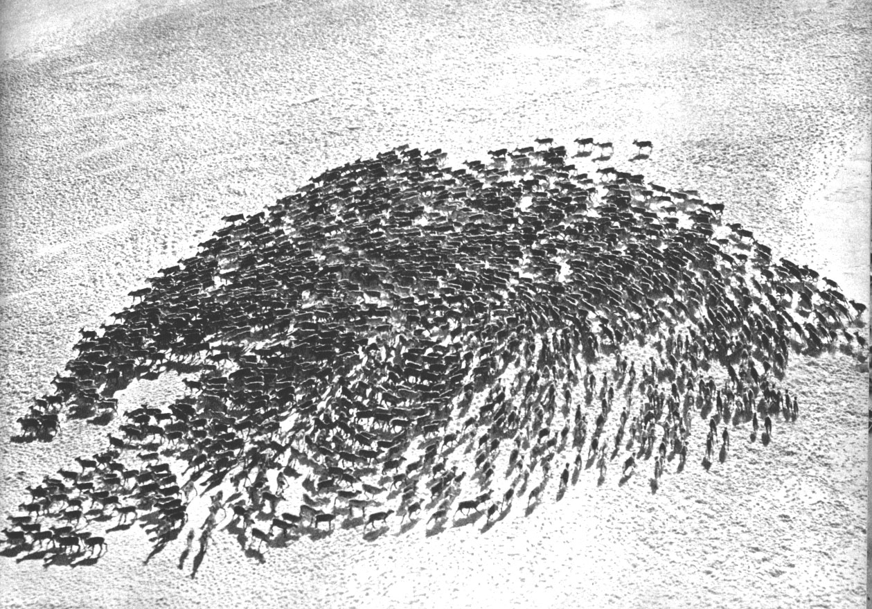
six the question here is WHY does this reindeer herd have the configuration we see? ...and what we see is the herd's reaction to the helicopter that shot the picture. Can you deduce whether the helicopter was going right-to-left or left-to-right?
seven and eight (Phnom Penh Cambodia, 1973 and 1985)
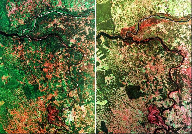
eight point five (rainforest in Brazil, 5 years between images)
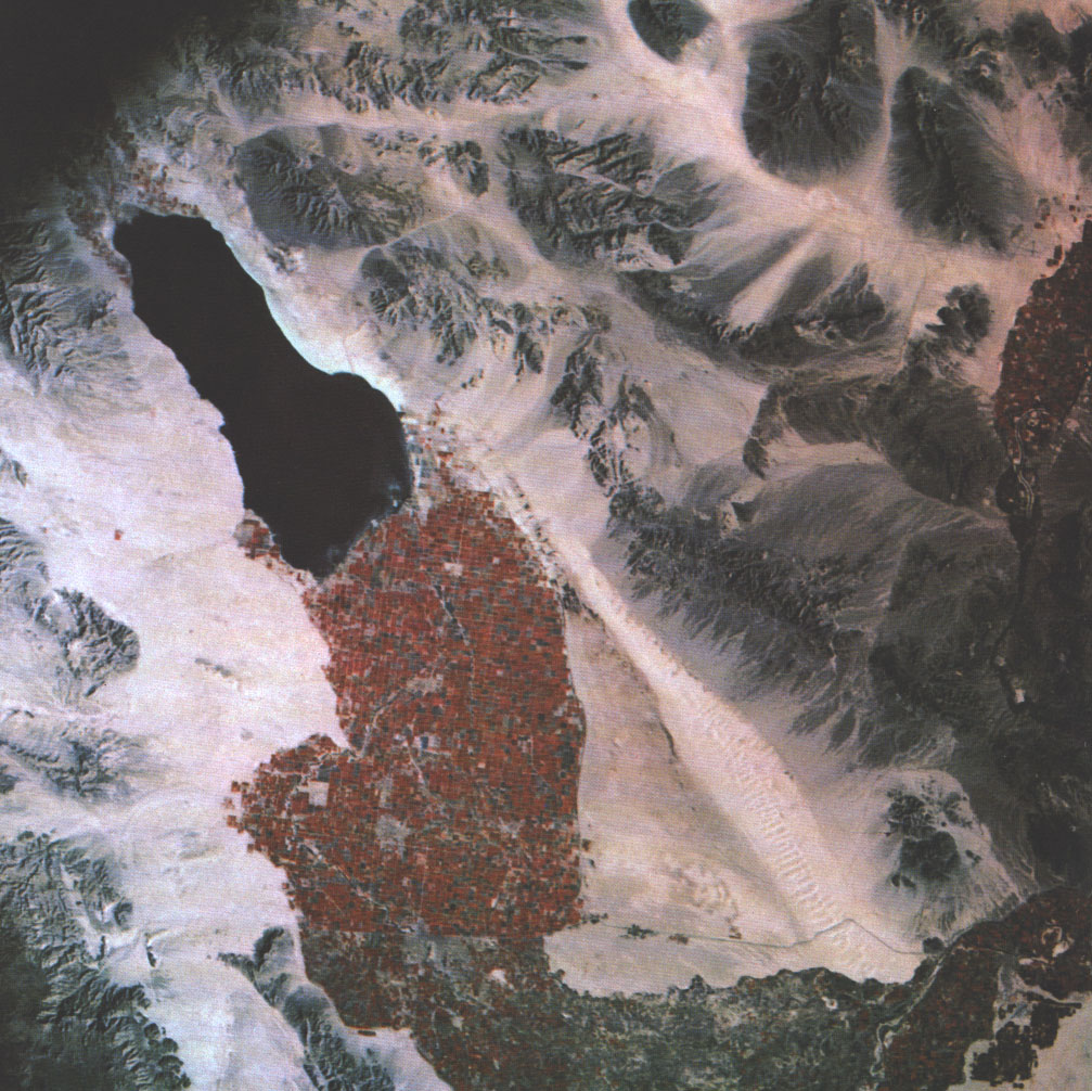
nine 1969: a photograph by an orbiting astronaut, in infrared color, of the Imperial Valley, California
ten a detail of the landscape of number nine, showing the twin cities of Calexico in California and Mexicali in Baja California
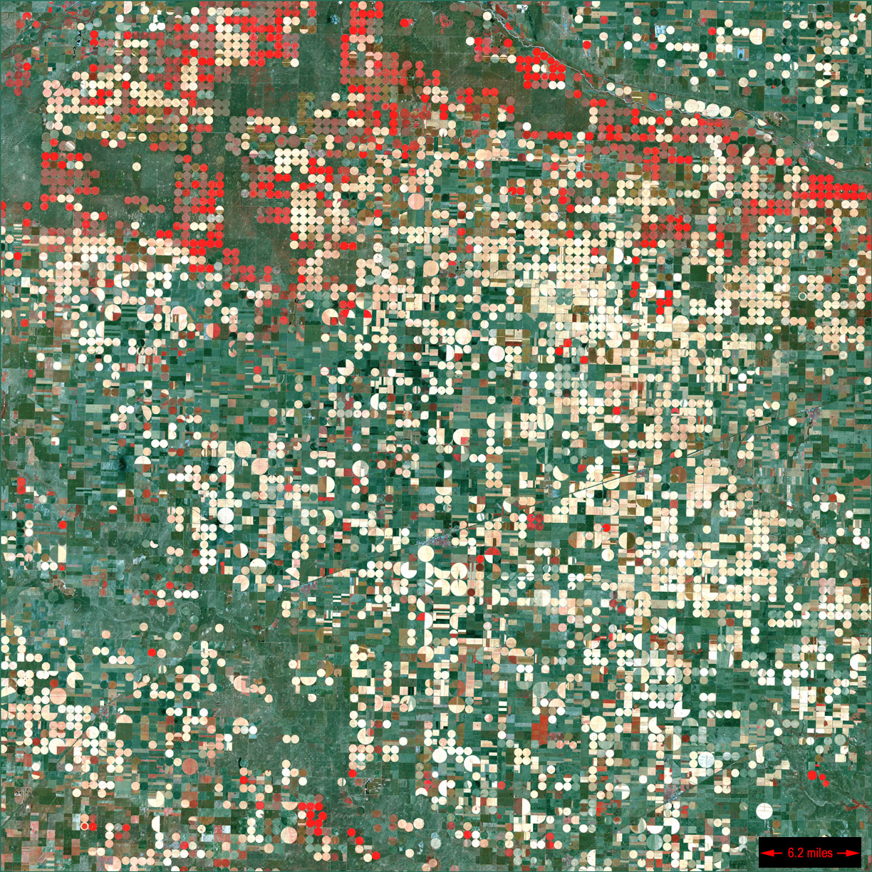
eleven A Kansas landscape of center-pivot irrigation (see more details, another picture, another, and The Promise Of High-Tech Irrigation (opinion, from the Hudson Institute), and comment on Garden City KS from NASA)
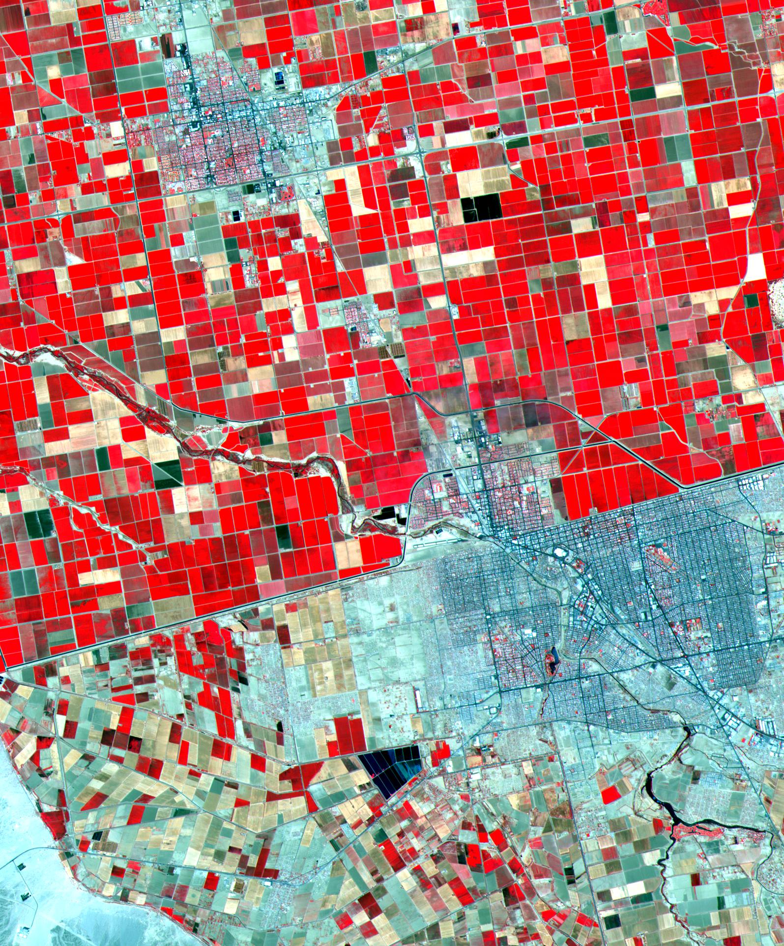
twelve Texas/New Mexico border: TX allows mining of subsurface water, NM does not
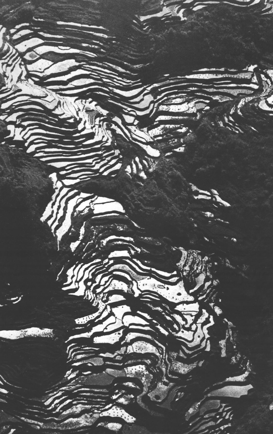
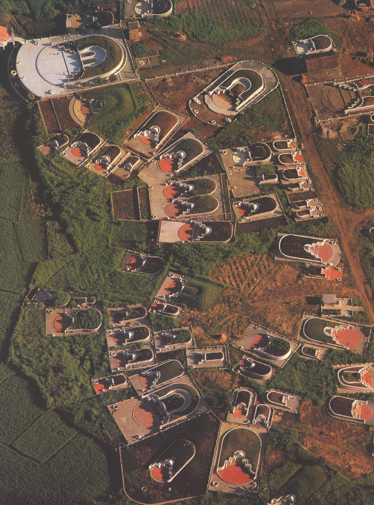
thirteen rice terraces in the Philippines ...one form of intensification of agriculture (point being: there are many ways to get more out of a piece of land...)
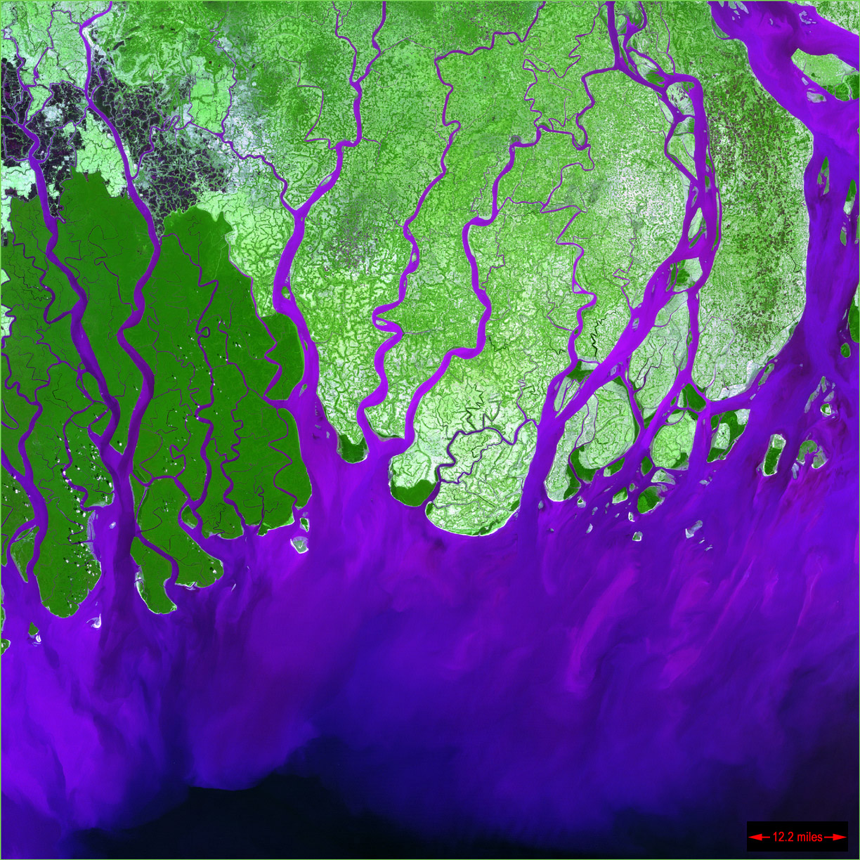
fourteen the mouth(s) of the Ganges, an area called the Sundarbans --largest mangrove swamps in the world
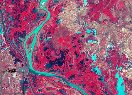
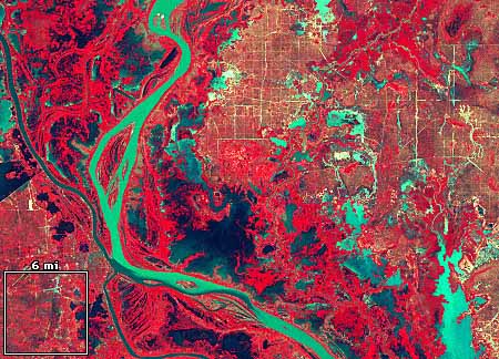
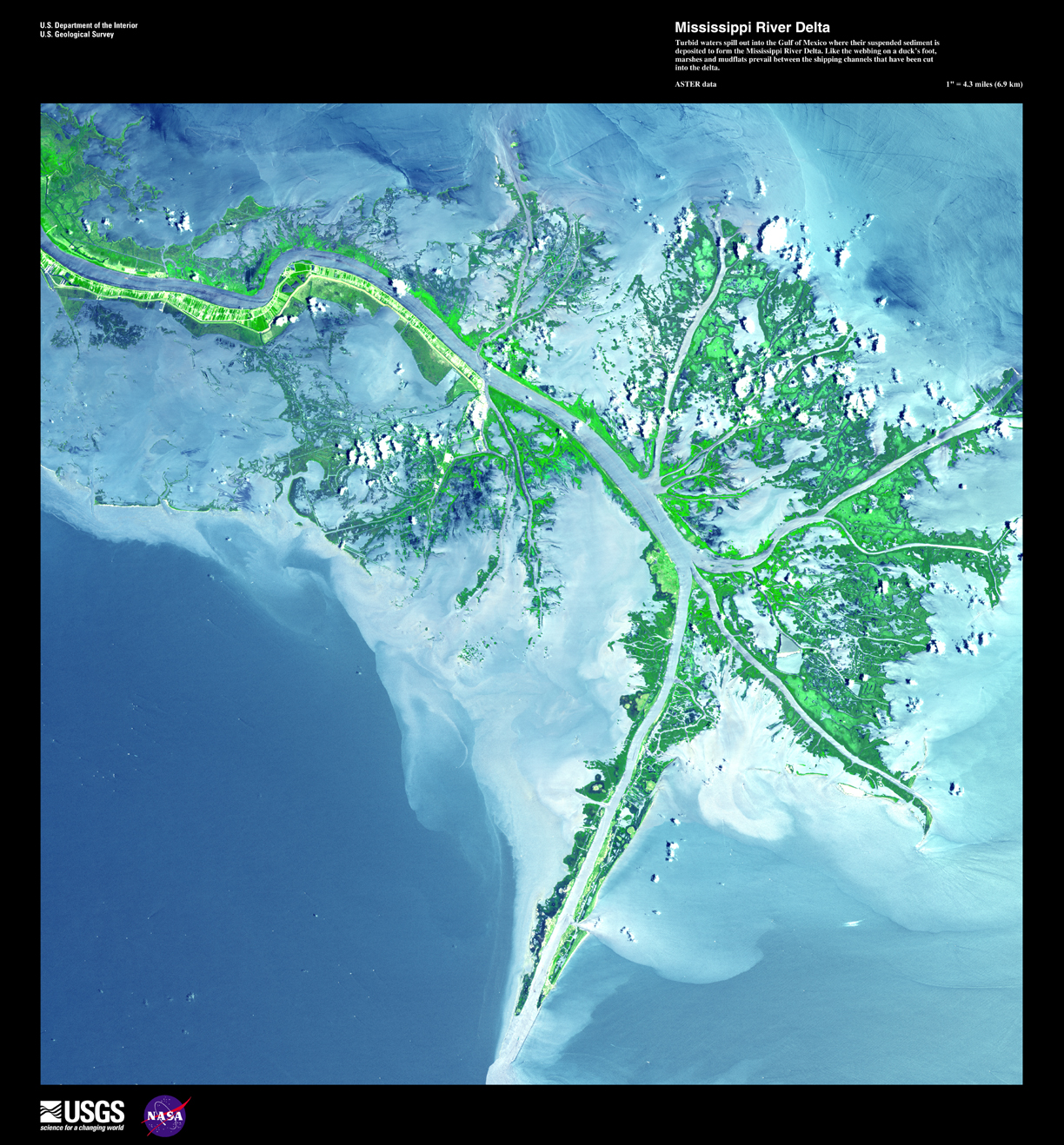
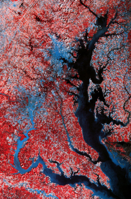
fifteen birdfoot delta of the Mississippi, made much more comprehensible by the material from McPhee's "Atchafalaya"
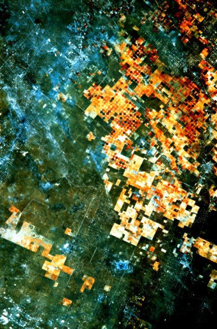
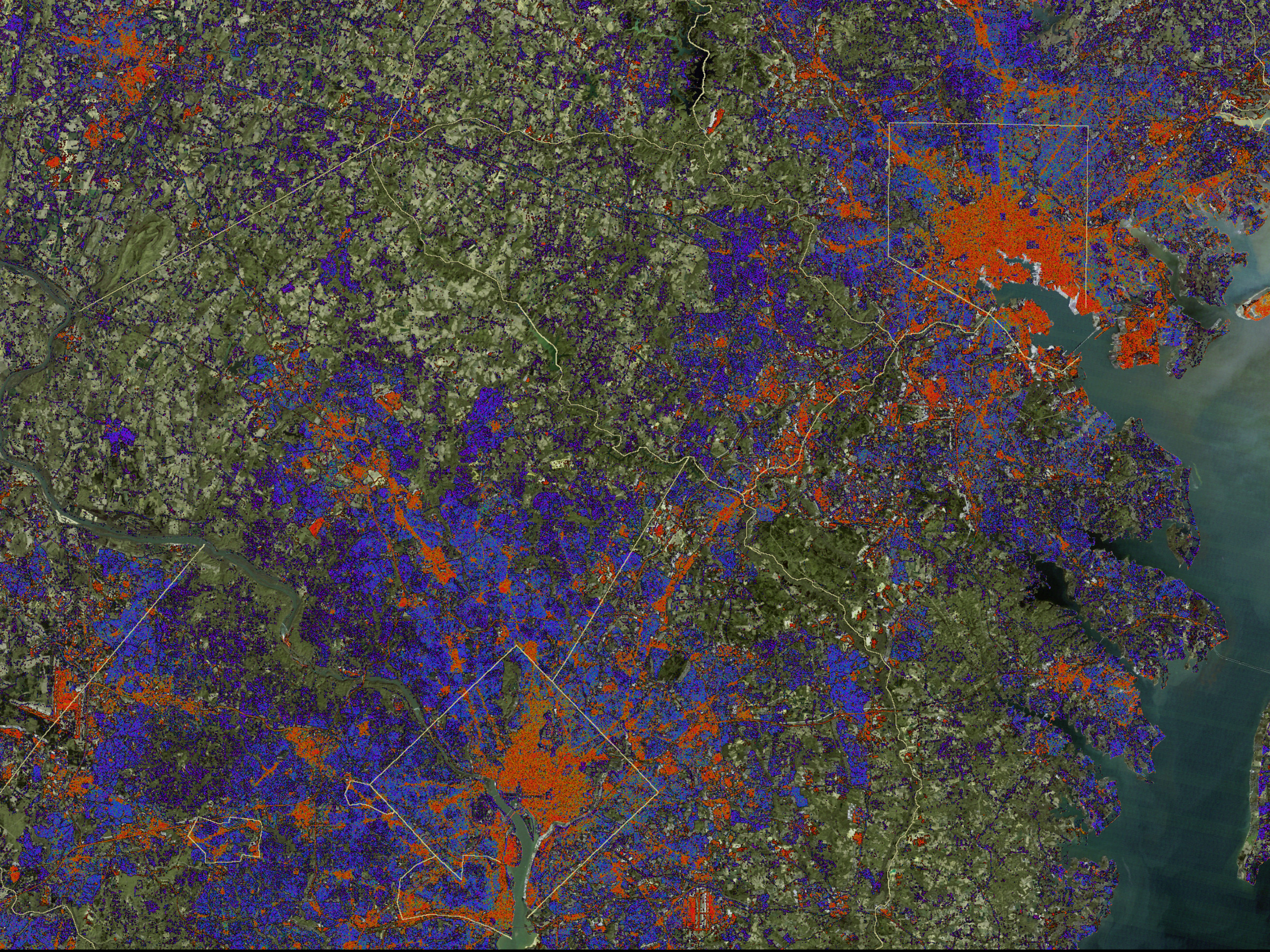
sixteen and seventeen ["impervious" surfaces are shown in red] and 17.5
eighteen (and think about animating processes)
nineteen consider the (multiple!) implications of this level of detail in remote sensing technologies...
twenty Chinese cemetery in Sumatra
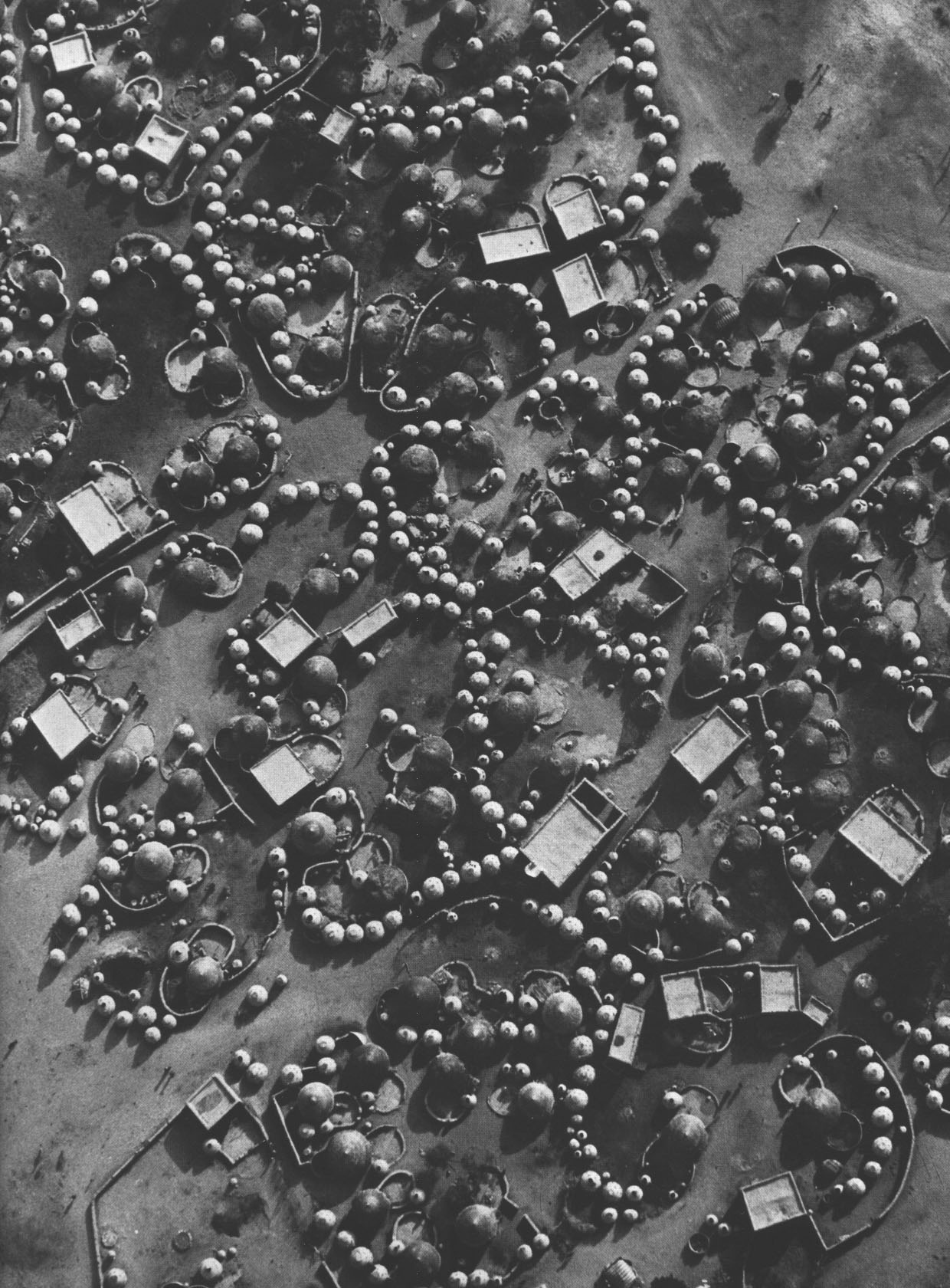
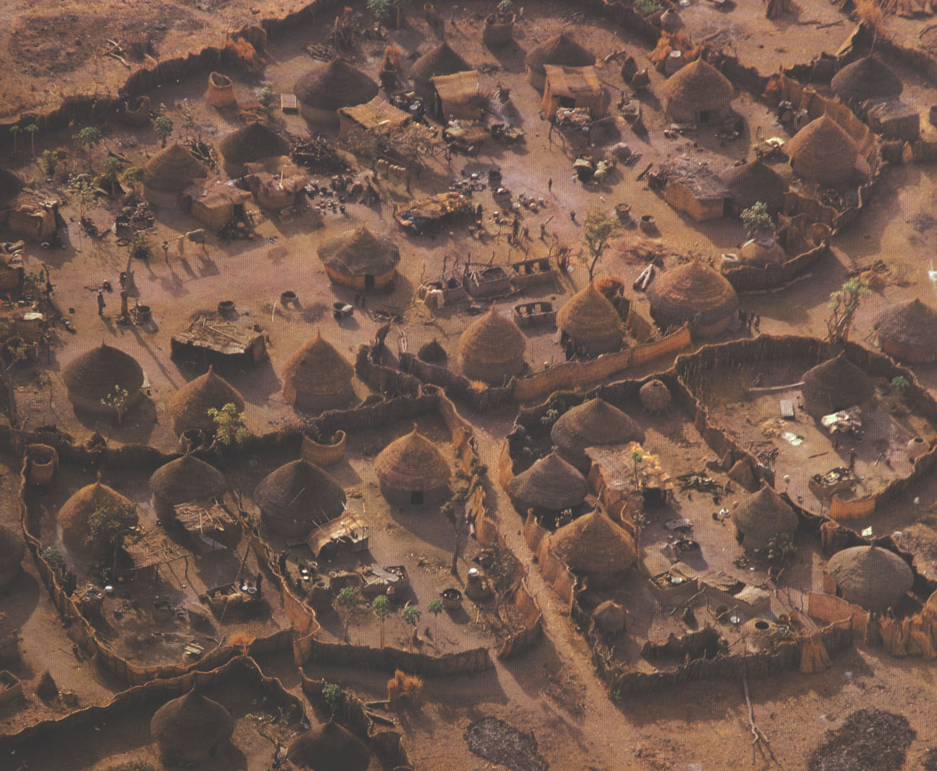
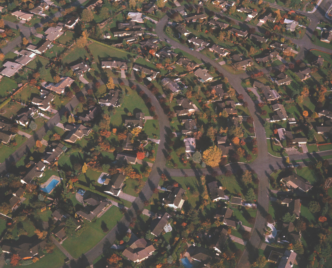
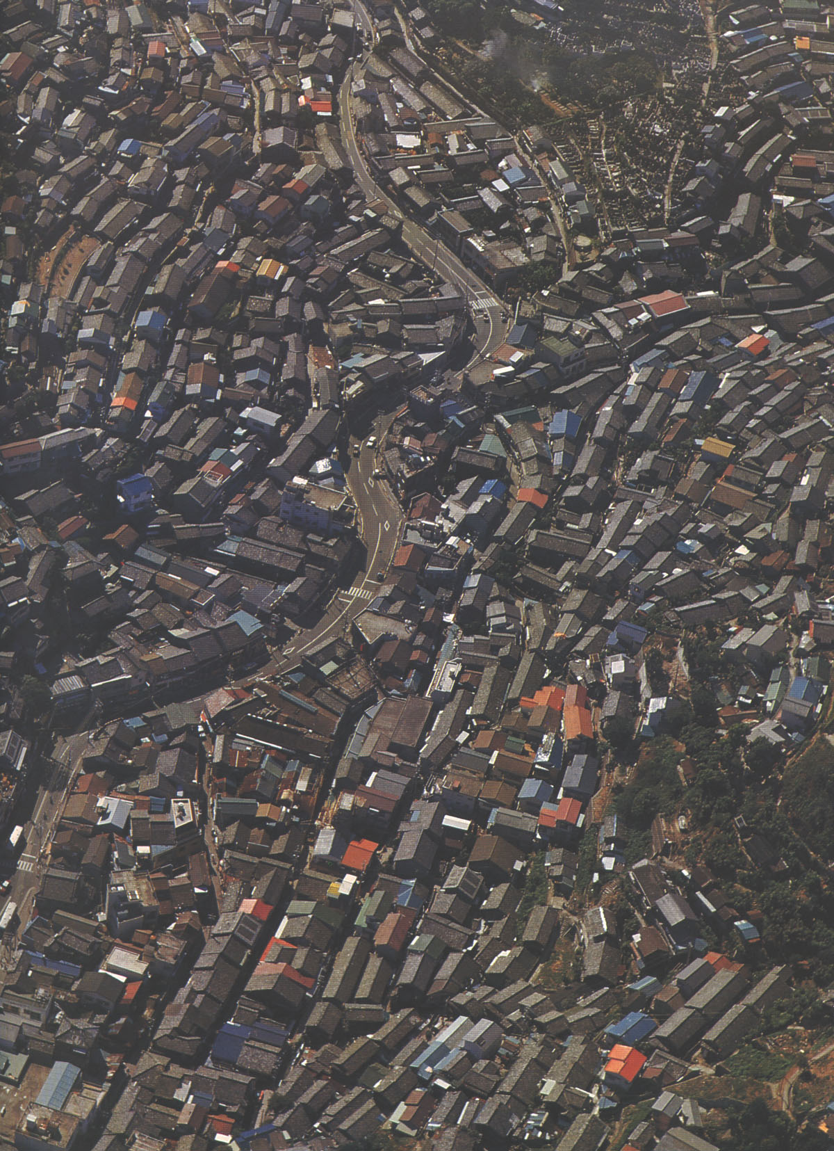
21, 22, 23, 24, 25, 26 (Algeria, Mali, Nigeria, Seattle suburbs, Japan... and oops Sumatra again)
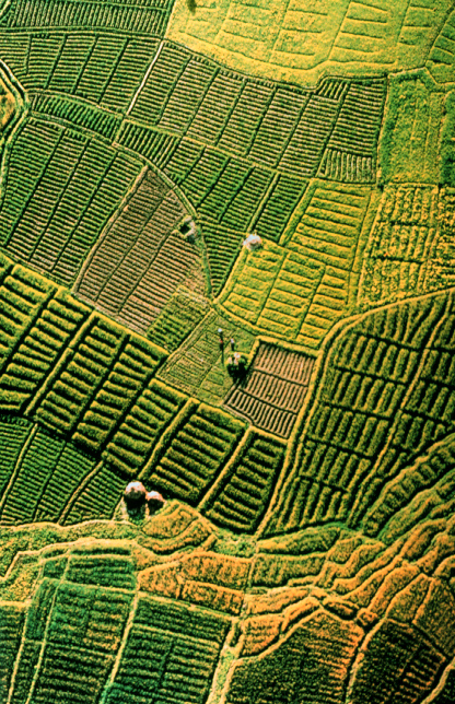
27, 28, 29, 30 four more examples of intensification of agriculture
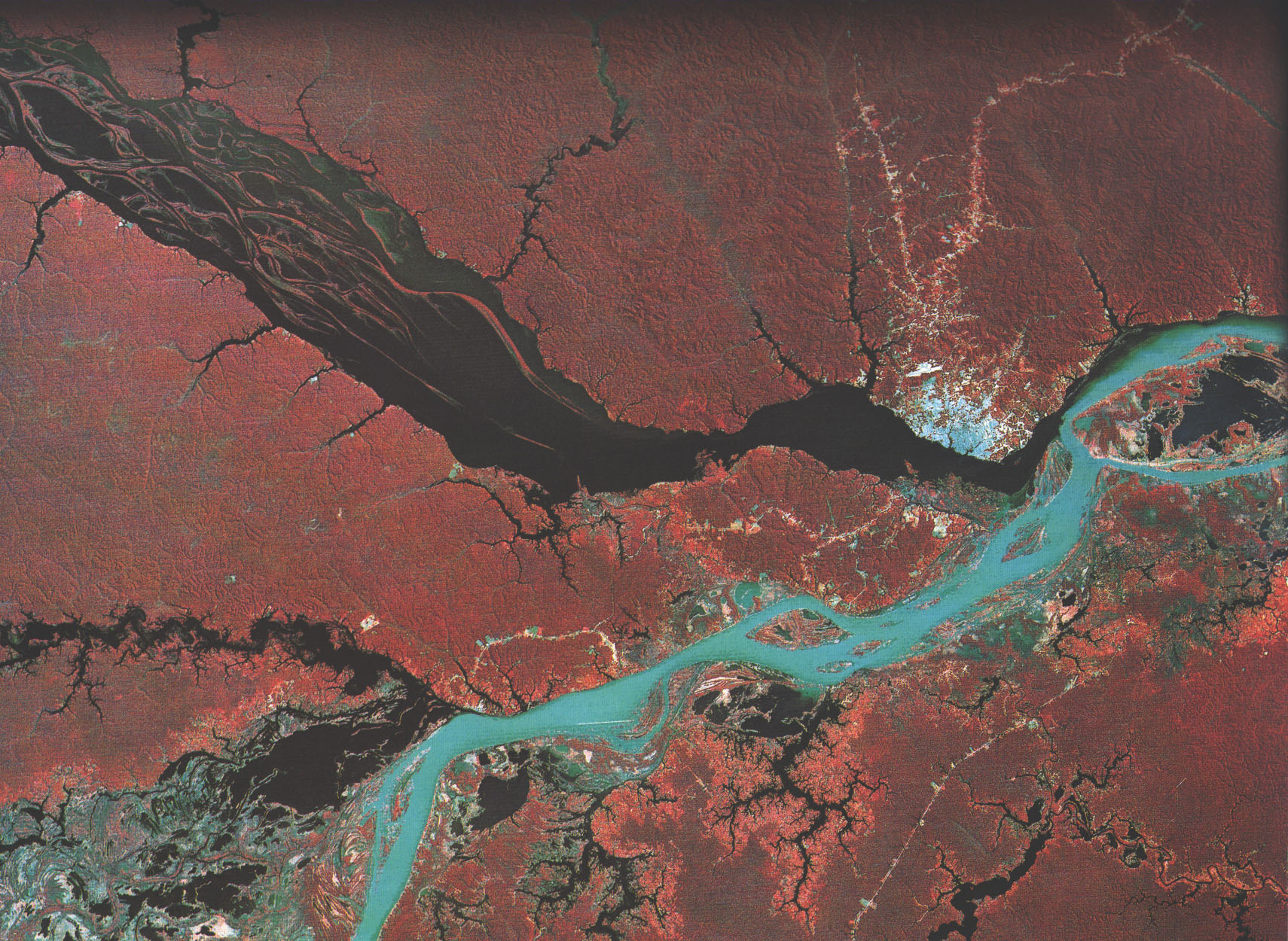
31 Manaus, Amazonas, Brasil: the confluence of Rio Solimoes and Rio Negro ("The Amazon")
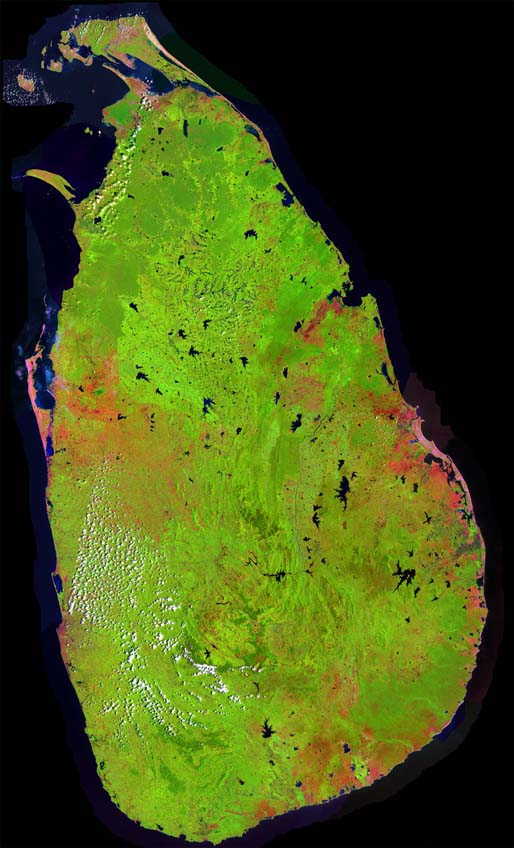
32 the whole island of Sri Lanka, also known formerly as Ceylon and even more formerly as Serendib --see OED entry for more
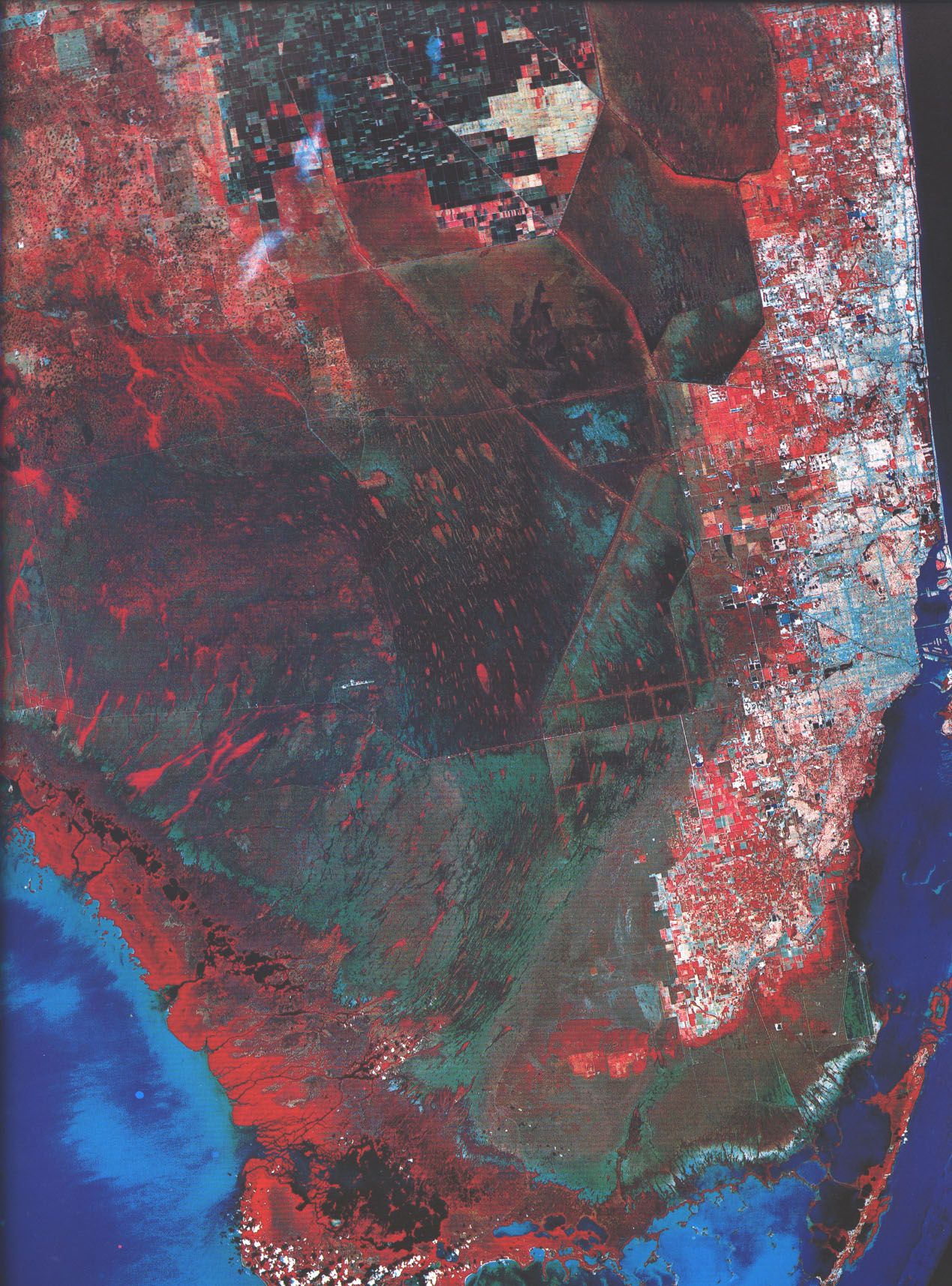
33 sure enough, South Florida. We see Miami, what's left of the Everglades, and on the northern edge, the Belle Glade area in which North America's cane sugar is produced. See this news story, and a raft of others too. See also IN THE KINGDOM OF BIG SUGAR by Marie Brenner