double-click pwt61
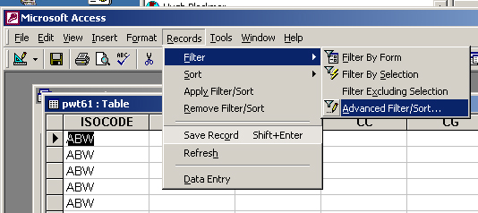
From the 'Filter' menu, choose 'Advanced Filter/Sort'
From the 'Field:' dropdown, choose YR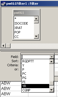
In the 'Criteria:' field, type the desired year to be filtered
Click the 'Apply Filter' icon in the menubar (a funnel)
Choose 'Export' from the File menu and save in .dbf format
Click on the Funnel icon again to REMOVE the filter
(thus, I made r:/global/pwt6199 and /pwt6198 for 1999 and 1998 data)
use the Add Data icon and navigate to: R:\esri2003\world\ and add cntry02.shp
use Add Data to navigate to: R:\global\ and add pwt6199.dbf
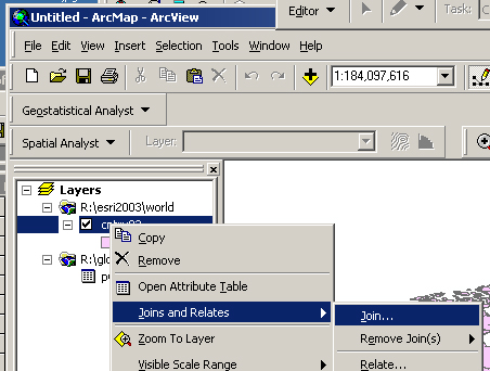
Right-click cntry02, choose 'Joins and Relates' and left-click 'Join'
Fill in the form: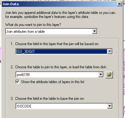
Click OK to JOIN the 1999 data to the Attribute table of cntry02.shp
(open the attribute table to check that data have been added)
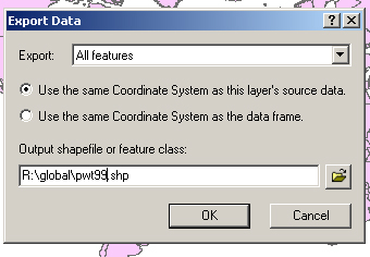
Right-click cntry02.shp and choose 'Data' and 'Export Data', and save to desired location