 (the RED is available as
digital maps; the medium blue is "large scale final maps" but evidently
not yet digital)
(the RED is available as
digital maps; the medium blue is "large scale final maps" but evidently
not yet digital)
Wetland Plants and Plant Communities of Minnesota and Wisconsin
Aquatic and Wetland Vascular Plants of the Northern Great Plains
Robert K. Godfrey and Jean W. Wooten. Aquatic and Wetland Plants of the Southeastern United States: Dicotyledons. 1981. (on order)
Anderson, R. R. and R. T. Macomber. 1980. Distribution of Submersed
Vascular Plants, Chesapeake Bay, Maryland. Final Report to U.S. EPA, Chesapeake
Bay
Program, Annapolis, MD. Grant No. R805970. 126 pp.
Boutin, C. and P. A. Keddy. 1993. A functional classification of wetland plants. Journal of Vegetation Science 4: 591-600.
Weiher, E., I. C. Wisheu, P.A. Keddy and D.R.J. Moore. 1996. Establishment,
persistence, and management implications of experimental wetland plant
communities.
Wetlands 16: 208-218.
Weiher, E. and P.A. Keddy. 1995. The assembly of experimental wetland plant communities. Oikos 73: 323-335.
BUBL 'Plant distribution' links
Checklist of Online Vegetation and Plant Distribution Maps (Compiled by Claire Englander and Philip Hoehn, UC Berkeley) and US sections of same
Aquatic GAP Analysis (pretty spotty so far...)
National Wetlands Inventory Center and National Wetlands Research Center
Midwestern Wetlands Flora and Northeast Wetland Flora and Western Wetland Flora and Southern Wetland Flora
National lists of plants that occur in wetlands and USFW Branch of Habitat Assessment (see MEKA/MARSH software)
FIELD INDICATORS OF HYDRIC SOILS
Wetland Indicator Species Searches
Wetland Biogeochemistry Institute
Wetland Hydrology, Water Quality, and Associated Functions (Virginia Carter, USGS)
2 May
After a conversation with JoAnn Mills of the Wetlands Inventory I made
this
summary of data possibilities
8 June
To summarize what I think John wants to do, and what I can do to assist
in the three projects I'm aware of:
At the FWS site there's a way to get DLGs (and I've got one in c:\esri\knoxmaps\sddlg\ for Studarts Draft), and the Help tells us that "Data Automation Kit (Windows only) provide conversion utilities which convert data from DLG format to a coverage "...so I tried to install DAK and it went through the process but there's no icon or .exe anywhere....
It looks like downloading the quads in .e00 form from ftp://www.nwi.fws.gov/arcdata/
and processing them MAY be the eassiest path, but the requisite quads are
stored in larger units --like 'charlottesville' and 'roanoke' ("data are
organized by USGS 250k map name and so it is advisable to have a USGS index
book for the state in which your desired quads are located") and there's
a LOT of extracting and converting to be done...
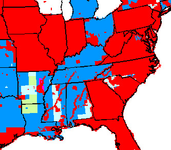
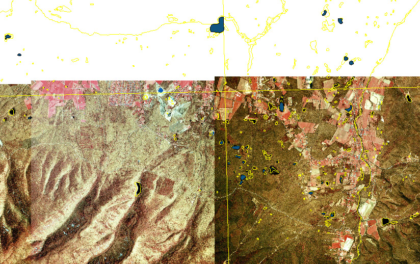
This graphic (from http://wetlands.fws.gov/webstat.gif) indicates the
present state of data:
(the RED is available as
digital maps; the medium blue is "large scale final maps" but evidently
not yet digital)
USGS MapFinder provides an index map to quads.
On to soil maps. USDA STATSGO ("Mapdata are in Arc7.0 Coverages, GRASS4.1.3 Vector format, and DLG-3 Optional format") and SSURGO for more detail, but spotty coverage:
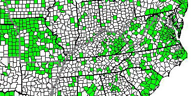
(from http://www.ftw.nrcs.usda.gov/jpg/archived.jpg)
(Augusta County is VA015, and Boutetourt VA023 --but I couldn't retrieve data from either ['document contained no data'])
From Kurt Snider:
Tennessee Wetlands
by county ...from GIS Spatial Data
Layers for TN
12 June
We need to add the wetlands data for the quads Chuck worked with last
year (see Chuck's
map, which is Q:\knox\allquads8.apr --this is just a portion of the
whole) and see how well the FWS categories fit with what we know...
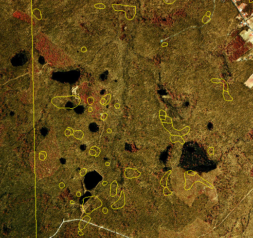
After a couple of hours of fiddling: Q:\knox\allquads9.apr includes the FWS ponds, with those in PEM and PFO in color (others made colorless)... but the question is, are the FWS categories actually useful, and do they correspond to what we know about the ponds? See FWS codes for 'Palustrine' for details. This is all a bit confusing to me: there are a LOT of wetlands in those 8 quads (250 in the category PEM1A and 128 in PFO1A, for example), and I'm not sure in which H. virginicum is present --just those on Chuck's map of ponds?
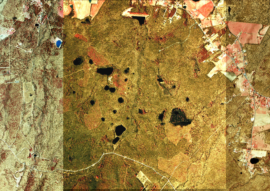
Skip's mapleflats
site
and this image from TerraServer:
VA DOQQs are available at Radford... and here's Sherando and Big Levels:
13 June
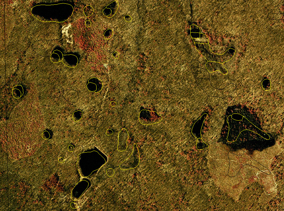
I added these DOQQs to the coverage, but they don't exactly line up...
which I suppose may have to do with 1927 and 1983 differences... about
210 meters difference.
This is the sort of recurring problem that I _ought_ to know how to
solve... and that we need a Tutorial page to deal with... So I messed with
ArcView's Projection Utility, figuring that the FWS was probably in 1927
(I had to convert it to a .shp first, THEN reproject and change the datum,
and the result is better, certainly, but that's a lot of fiddling around
to have to do:
...and a bit later, after much reprojecting, here's an image of q:\knox\13vi12n.apr,
incorporating Chuck's ponds as a (blue) layer:
Here's a summary as of 13 June of current state and future directions
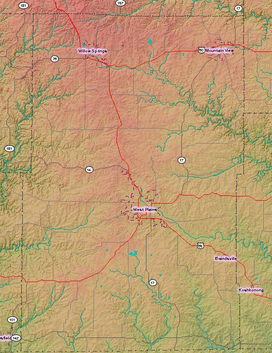
...and I grabbed the 6 adjacent quads including Pomona MO (q:\knox\pomona.apr) ...see also ftp://msdis.missouri.edu/pub/county/utm/howell/ (data saved in .gz form in c:\jsk\pomona ...but for some reason it declines to unzip)
14 June
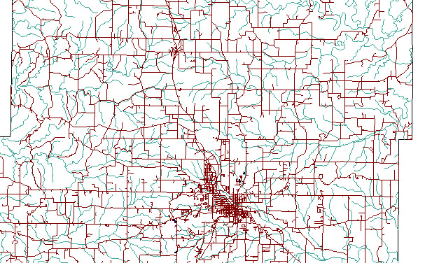
Here's the TIGER coverage for Howell County MO, thanks to John Blackburn:
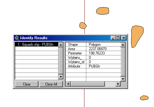
and the wetlands data don't quite line up (but I'm not exactly sure why... it's about 350m offset, so it looks like a datum issue), but the pond John identifies as the ONE with Helenium virginicum is classified as PUBGh (along with 3895 others on those 6 quads, making me a bit dubious about the uniformity of the classification of MO ponds):
Skip's page on Missouri
clays : Howell county seems to have a LOW number of caves, and to be
surrounded by (on W, N, E anyway) by counties with substantially more.
Managed to transform the 1927 wetlands map for Howell to the 1983 datum, and it works... q:\knox\howellMO\onepond83datum.apr
18 June
Old
State Bedrock Map for Ohio and Geology
of Kentucky (and their GIS
Data Library )
I put GIS coverage of (some? all?) KY karst in q:\knox\kykarstdye\
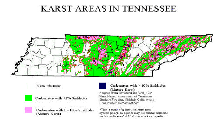
Wetlands data for KY are available via http://www.kfwis.state.ky.us/KFWIS/DownloadNWIP/download.htm by county, and the metadata record gives a nice summary of the coding system. See also their presentation of quad location information. And http://water.nr.state.ky.us/dow/dwover.htm mentions that 55% of KY is underlain by karst.
Karst link page including dyetracing.com for general information
 (from http://www.isgs.uiuc.edu/servs/pubs/geobits-pub/geobit7/geobit7.html)
Missouri Caves, Karst, and Springs
 (from http://www.caves.org/conservancy/ikc/
see also http://www.caves.org/conservancy/ikc/slide_3.htm)
(from http://www.caves.org/conservancy/ikc/
see also http://www.caves.org/conservancy/ikc/slide_3.htm)
"...Mississippian Karst of KY, TN..."
19 June
Global Change Research
and Karst
(from http://gwpc.site.net/gwreport/Acrobat/Tennessee.pdf)
Atlas of Tennessee Vascular Plants and by counties
 H. amarum
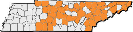 H. autumnale
 H. brevifolium
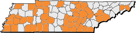 H. flexuosum
Baskauf, Carol J. 1997. Population genetic studies of plants endemic
to karst, with an emphasis on the limestone glades of
Tennessee. Symposium of the Karst Waters Institute, "Conservation
and Protection of the Biota of Karst", Special Publication 3:
2-4. (from http://www.apsu.edu/baskaufc/cv.htm
--she's BaskaufC@apsu.edu)
20 June
Purdy soils:
Iowa summary ("...The Purdy series consists of very deep, poorly drained or very poorly drained soils with slow or very slow permeability. They formed in slackwater-deposited alluvial materials on terraces...")Howell MO from Missouri Spatial Data Information Service:
And after a whole lot of fiddling around with .e00 from SSURGO soil map for Augusta County (in q:\knox\augusta\, soils.shp and 62B.shp --from http://www.ftw.nrcs.usda.gov/ssur_data.html), here's an image of the Maple Flats area:
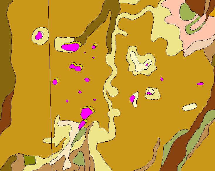
basically they're on "62B", though KMM is surrounded by "62C"
Here's an extract of "62B":
I haven't yet been able to find out the proper name of "62B" ... but Tracy says it's Monongahela , sometimes associated with Blago and Tygart and Zoar ("on adjoining terraces"), but I haven't got numbers for those series yet... but see soiltypes for what looks like a list.
And here's what I think is Purdy: "67" anyhow, and not all that clearly
related:
(the above is saved at q:\knox\augustasoils.apr)
From plants.usda.gov:
| Symbol | Scientific Name | Common Name | |
|---|---|---|---|
| AMSE | Amblyolepis setigera DC. | huisache daisy | |
| HESE2 | Helenium setigerum (DC.) Britt. & Rusby | ||
| HELEN | Helenium L. | sneezeweed | |
| HEAM | Helenium amarum (Raf.) H. Rock | yellowdicks | |
| HEAMA | Helenium amarum (Raf.) H. Rock var. amarum | yellowdicks | |
| HETE14 | Helenium tenuifolium Nutt. | ||
| HEAMB2 | Helenium amarum (Raf.) H. Rock var. badium (Gray ex S. Wats.) Waterfall | yellowdicks | |
| HEBA | Helenium badium (Gray ex S. Wats.) Greene | ||
| HEAR2 | Helenium arizonicum Blake | Arizona sneezeweed | |
| HEAU | Helenium autumnale L. | common sneezeweed | |
| HEAUA | Helenium autumnale L. var. autumnale | common sneezeweed | |
| HEAUC | Helenium autumnale L. var. canaliculatum (Lam.) Torr. & Gray | ||
| HEAUP | Helenium autumnale L. var. parviflorum (Nutt.) Fern. | ||
| HECA24 | Helenium canaliculatum Lam. | ||
| HELA21 | Helenium latifolium P. Mill. | ||
| HEPA15 | Helenium parviflorum Nutt. | ||
| HEAUG | Helenium autumnale L. var. grandiflorum (Nutt.) Torr. & Gray | fall sneezeweed | |
| HEMA12 | Helenium macranthum Rydb. | ||
| HEAUM | Helenium autumnale L. var. montanum (Nutt.) Fern. | mountain sneezeweed | |
| HEMO9 | Helenium montanum Nutt. | ||
| HEBI | Helenium bigelovii Gray | Bigelow's sneezeweed | |
| HERI4 | Helenium rivulare (Greene) Rydb. | ||
| HEBO2 | Helenium bolanderi Gray | coastal sneezeweed | |
| HEBIF | Helenium bigelovii Gray var. festivum Jepson | ||
| HEBR | Helenium brevifolium (Nutt.) Wood | shortleaf sneezeweed | |
| HECU6 | Helenium curtisii Gray | ||
| HECA13 | Helenium campestre Small | oldfield sneezeweed | |
| HEDR2 | Helenium drummondii H. Rock | fringed sneezeweed | |
| HEFI2 | Helenium fimbriatum auct. non (Michx.) Gray | ||
| HEEL | Helenium elegans DC. | pretty sneezeweed | |
| HEELA | Helenium elegans DC. var. amphilobum (Gray) Bierner | pretty sneezeweed | |
| HEAM10 | Helenium amphilobum Gray | ||
| HEELE2 | Helenium elegans DC. var. elegans | pretty sneezeweed | |
| HEFL | Helenium flexuosum Raf. | purplehead sneezeweed | |
| HEFL9 | Helenium floridanum Fern. | ||
| HEGO2 | Helenium godfreyi Fern. | ||
| HENU3 | Helenium nudiflorum Nutt. | ||
| HELI | Helenium linifolium Rydb. | slimleaf sneezeweed | |
| HEMI | Helenium microcephalum DC. | smallhead sneezeweed | |
| HEMIM | Helenium microcephalum DC. var. microcephalum | smallhead sneezeweed | |
| HEMIO2 | Helenium microcephalum DC. var. ooclinium (Gray) Bierner | smallhead sneezeweed | |
| HEOO2 | Helenium ooclinium Gray | ||
| HEPI | Helenium pinnatifidum (Nutt.) Rydb. | southeastern sneezeweed | |
| HEIN8 | Helenium incisum (Torr. & Gray) Wood | ||
| HEVE5 | Helenium vernale auct. non Walt. | ||
| HEPO2 | Helenium ×polyphyllum Small (pro sp.) [autumnale × flexuosum] | ||
| HEPU2 | Helenium puberulum DC. | rosilla | |
| HEDE8 | Helenium decurrens (Less.) Vatke, non Moench | ||
| HEQU | Helenium quadridentatum Labill. | longdisk sneezeweed | |
| HETH | Helenium thurberi Gray | Thurber's sneezeweed | |
| HEVE | Helenium vernale Walt. | savannah sneezeweed | |
| HEHE11 | Helenium helenium (Nutt.) Small | ||
| HENU4 | Helenium nuttallii Gray | ||
| HEVI6 | Helenium virginicum Blake | Virginia sneezeweed | |
| HYHO | Hymenoxys hoopesii (Gray) Bierner | owl's-claws | |
| HEHO5 | Helenium hoopesii Gray |
21 June
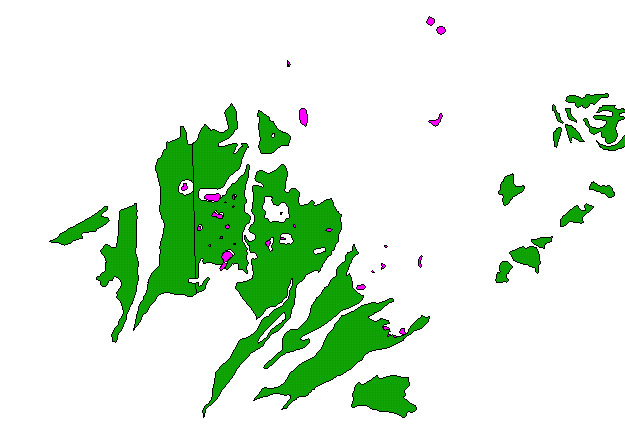
And here's a bit of the Rockingham spoils map (q:\knox\rockingham\allsoils.shp),
showing the 5 ponds from newchuck.shp which are identified as having H.
virginicum:
The soils, from lower left to upper right, are 8B (BUCHANAN COBBLY FINE SANDY LOAM), 54A (PURDY SILT LOAM), 40C (LAIDIG COBBLY FINE SANDY LOAM), 8B, and 40C (this project is at q:\knox\rockingham\soils.apr)
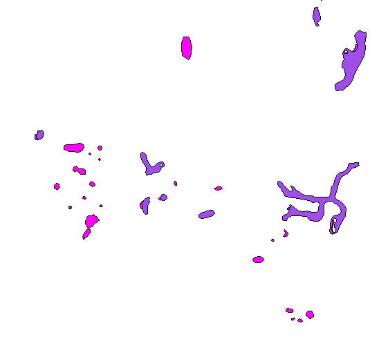
I've merged Augusta and Rockingham into one .shp file, for who-knows-what
purpose: q:\knox\augrocksoils.shp:
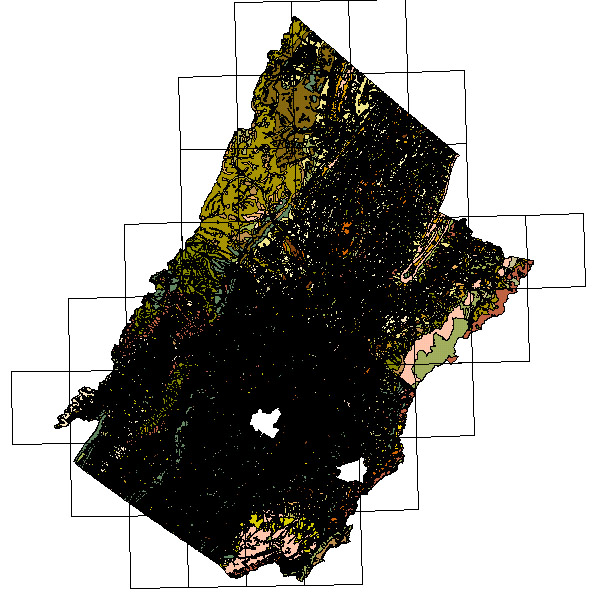
...but here's the not-entirely-unexpected problem:
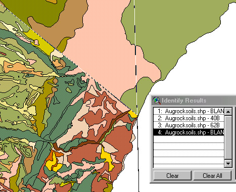
the cocoa-colored soil in the upper left hand corner in Rockingham is coded as '40B', but in Augusta it's the pea-green identified as '62B', and clearly the upper corner of