On pg. 23 are two graphs, one for 'fish and seafood consumption' and the other for 'meat consumption', which have interesting connections... what are they?
And how about the maps (and accompanying text) in the sections on Foodcrops and Meat and Fish? And what are the maps we'd like to see?
Here are a few:
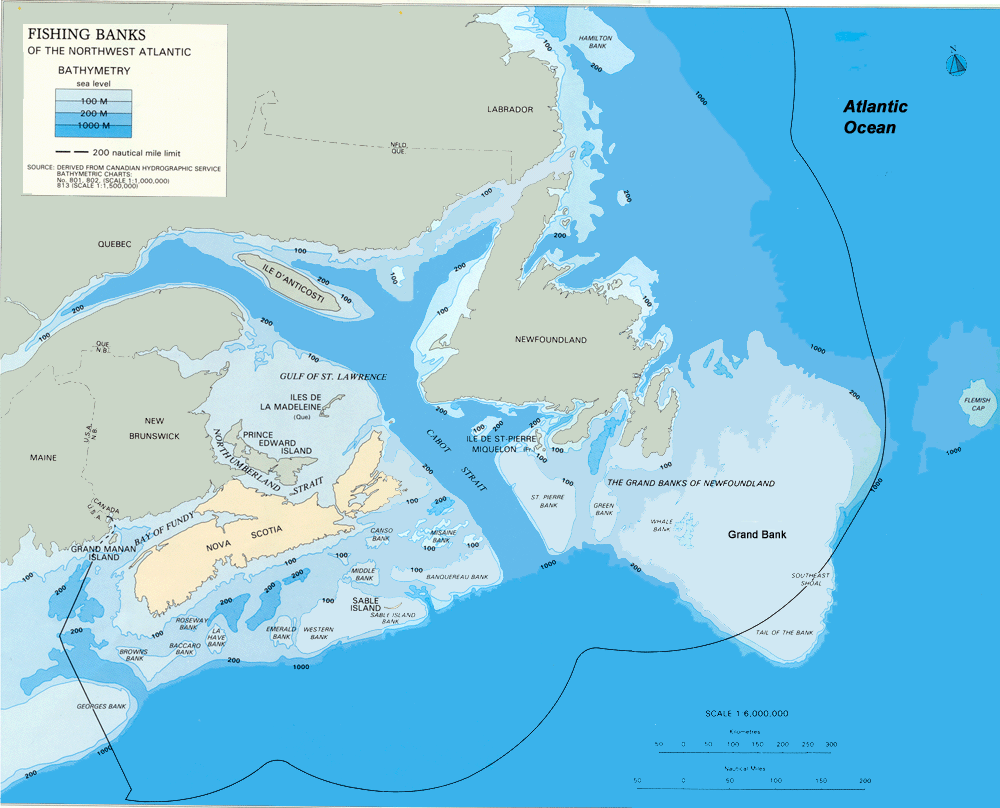
Northwest Atlantic Fishing Organization Fishing Areas...and of course that's only a tiny sample.Fishing Banks of the Northwest Atlantic
Catch Plots and Density Distribution Maps (Alaska)
Fisheries and Oceans Canada historical statistics
Newfoundland Salt Fisheries (a digital exhibit)
FAO Fisheries Global Information System (FIGIS)
FAO Tuna and Billfish Atlas (!!)
Common Fisheries Policy of the EC
NOAA Threatened and Endangered Marine Species - Critical Habitat (No-Entry Zones) and Steller Sea Lion Protection Measures (Alaska)
And for crops:
'98 '99 2000 for various US cropsIowa % farmland planted as soybeans
soybean and oil crops: maps and images gallery (Brazil, China, etc...)
Maps Generated from 1997 Census of Agriculture and 1998 USDA NASS
farm risk management: maps and images gallery