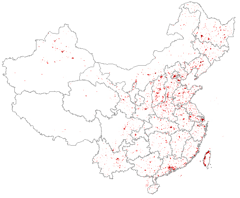
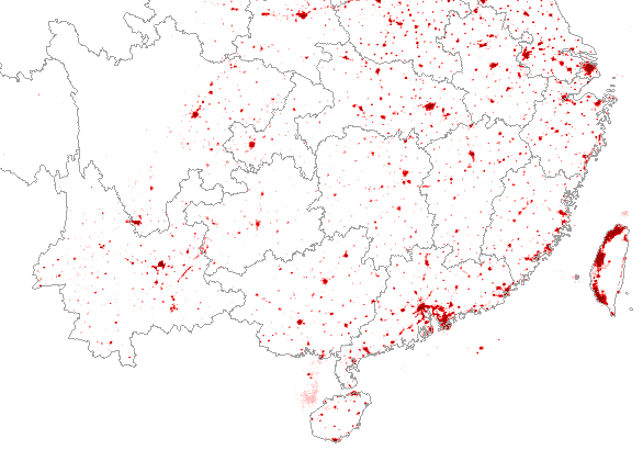
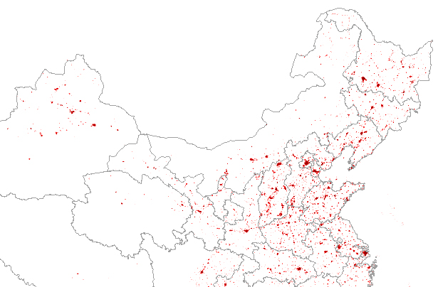
(this view is also available zoomed in a bit, for Southeastern China, for Northeastern China, and for Western China)
Take a look at your province's distribution... and remember that this is only one approximation to where the population is, indicating cities and ignoring the less densely settled rural areas surrounding them.